English · 16 October 2026
Your journey, at a glance
A place in mind. A clearer next step. This guide takes you from your first visit to a useful conversation with Vinyanda Holdings Limited (VHL).
- Explore Vinyanda
Read our story, meet the Board and understand the services being prepared.
- Locate and understand
Open Planning Atlas. Drop one pin, enter coordinates, choose a place or draw your own outline.
- Prepare and share
Choose your purpose, prepare an exploratory area brief, download it and email the files to VHL.
- Continue with Pato
Use pato.vinyandaholdings.com for marketing or finding real estate and planning for financing.
English · 16 October 2026
Find your way around the site
Use the same navigation patterns throughout the site. On a phone, choose Menu to reveal the main pages; choose a page to continue.
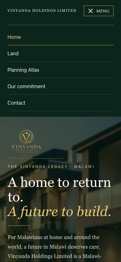
- Home
Scroll through the family story, the Board, service pathways and contact invitation. The Vinyanda name returns you to Home.
- Land
Explore acquisition, agricultural leasing, farm stewardship and family stewardship. Follow the relevant page and prepare your purpose, scale, budget, timing and questions.
- Planning Atlas
Explore mapped information, create a location brief and compare places. Coverage & roadmap and Sources explain what is available.
- Our commitment and Contact
Read the service standards and responsibility information. Contact opens the address, phone number and email route. Breadcrumbs above inner pages take you back through the hierarchy.
English · 16 October 2026
Find the place you mean
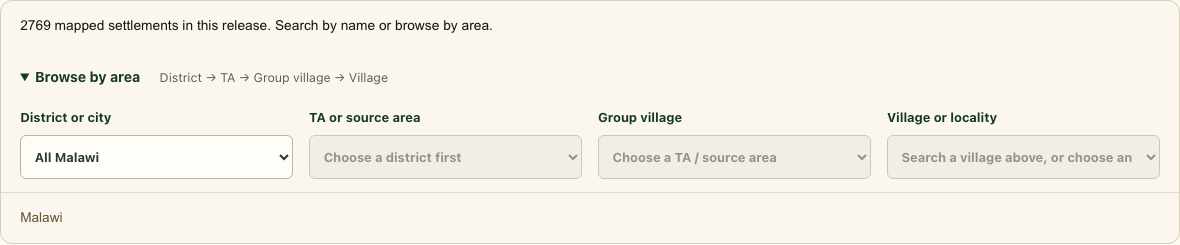
Open Planning Atlas, then choose the Find your place card to reach Where shall we begin?. You can start with a place name, exact coordinates or the area directory.
- Search by name
In Search a place or enter coordinates, type a village, town or district. Choose the matching result to open its record. Review its district and source, then choose Use [place] for my enquiry to activate it. If offered, choose Change area and explore first. Check the selected coordinates below the map.
- Browse by area
Choose District or city, then TA or source area, Group village where evidenced, and Village or locality. Use Next mapped settlements to see later results. Open the record, then choose Use [place] for my enquiry. Missing membership means evidence is incomplete.
- Use exact coordinates
Enter latitude first, then longitude, for example -16.035, 34.801. Choose Go to. Alternatively open Enter exact coordinates, fill both fields and choose Show this location.
- Check the result
A district or city boundary is area context. To prepare a point brief, place a pin or choose a specific mapped locality. A named place may be approximate. Use Place pin, Pin map centre or exact coordinates to choose a different point; its directory marker is read-only.
English · 16 October 2026
Drop a pin and use its coordinates
A pin identifies one location. The same report process works for a pin and for an outline. You do not need to draw a boundary for a point brief.
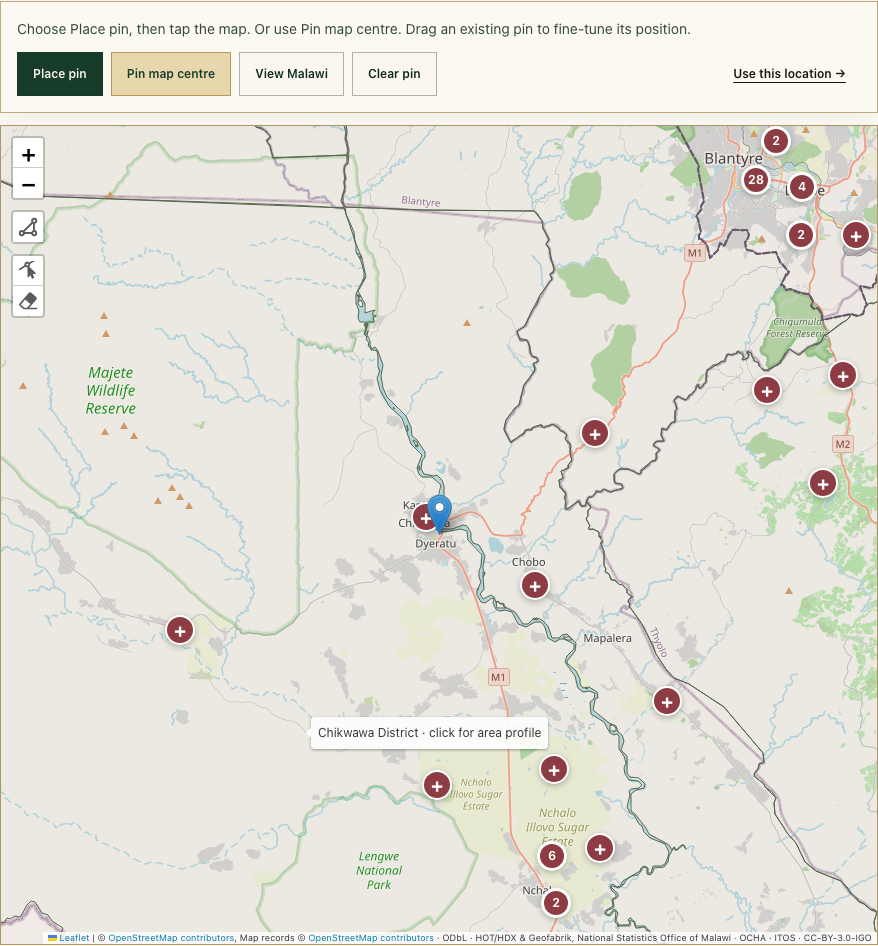
- Place the pin
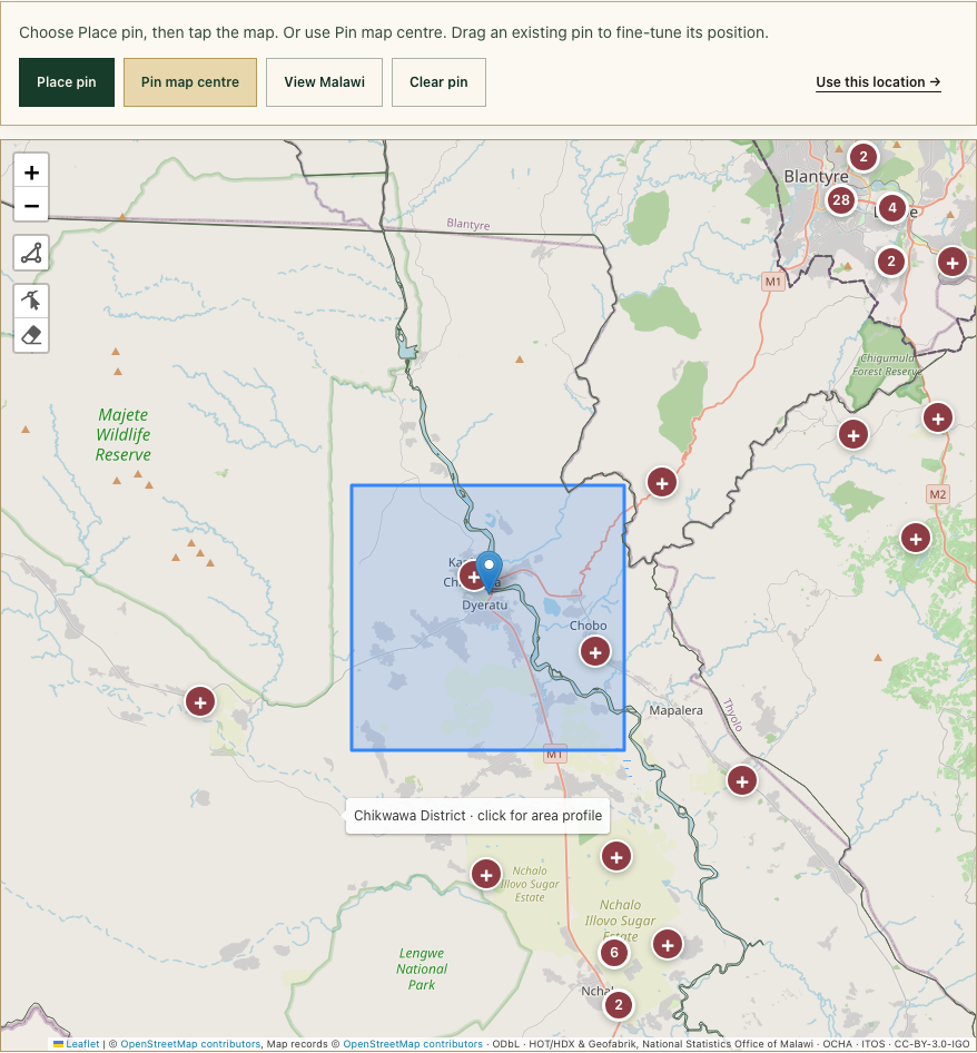
Choose Place pin, then click or tap the map once. The button enters placement mode; use Escape to cancel placement. Zoom or pan to the right place before placing it.
- Or use the map centre
Move the map until your place is at its centre and choose Pin map centre. This also offers a practical alternative to precise tapping.
- Fine-tune and check
Drag the pin to adjust it. Confirm the latitude and longitude under Your selected location or in Enter exact coordinates. Clear pin removes a point; View Malawi changes the view.
- Use this location
Choose Use this location. Your coordinates remain selected, and the purpose selector receives focus. Select your purpose and choose Prepare my area brief. Check that the report shows your intended coordinates.
English · 16 October 2026
Draw, adjust or remove an outline
Use an outline when you want to record several corners around an area. It is your approximate sketch; it does not change public map layers.
- Start your shape
Choose Draw approximate outline in the map toolbar. Tap or click each corner in order. Use at least three corners, then select the first corner again to finish.
- Check the captured outline
Look for Outline captured and Your selected location. The report uses the outline centre for nearby context and records the complete outline coordinates. It does not assess every part of the area.
- Edit or remove
Choose Edit your outline to adjust vertices; finish editing before continuing. Remove your outline deletes the drawing. If the shape is incomplete or invalid, redraw it without crossing its own edges.
- Prepare the report
Choose Use this location, choose a purpose and prepare the brief. Open Recorded outline coordinates in the report. After any edit, prepare a new report before downloading or sharing.
English · 16 October 2026
Read the map and its evidence
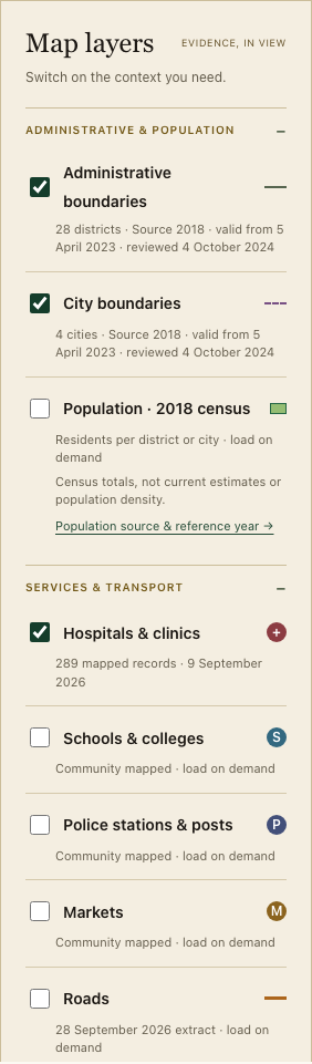
Switch layers on to answer a question. Use the legend to understand each symbol, line or shaded area.
- Choose useful layers
Toggle administrative boundaries, population, health, education, police, markets, roads and available context layers. Expand a group to see its controls and source notes.
- Explore records and profiles
Select a service marker for its name and source. Numbered circles group records: zoom in to separate them. Choose a district or city and Explore area profile for area context.
- Interpret carefully
Population is a 2018 whole-area census total. Service distances are straight-line distances, not travel routes. Roads do not establish access rights or condition. Historic flood coverage is not a current forecast.
- Check Sources and Coverage
Follow source links and Coverage & roadmap. Read dates, source owners, coverage and unresolved gaps. Planning documents are references; official site zoning is not displayed as a confirmed parcel assessment.
English · 16 October 2026
Prepare and understand your area brief
First check your selected point or outline. Then tell the Atlas what you are considering the land for.
- Choose your purpose
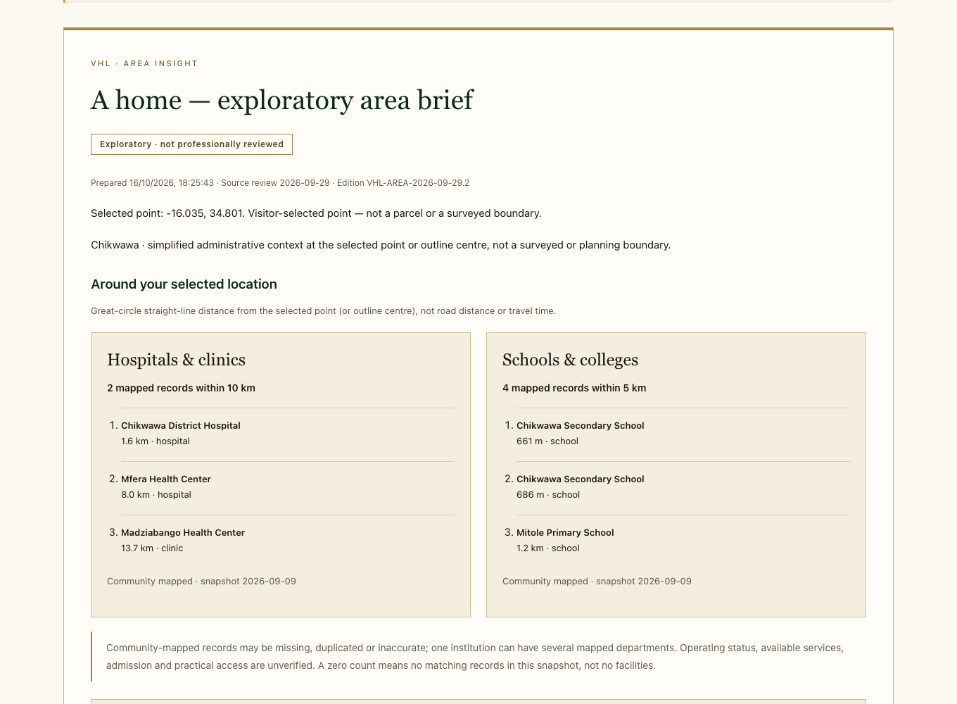
Choose A home, A place to retire, Farming & livelihoods, Logistics & manufacturing, A shop or local business, or Tourism & hospitality. Open The checks that matter for your purpose for the questions.
- Generate the brief
Choose Prepare my area brief and wait for Your exploratory brief is ready. Confirm the purpose, coordinates, date and evidence edition at the start of the report.
- Read all three panels
Purpose fit frames the questions. Constraints & unresolved prerequisites explains what needs resolving. Evidence completeness shows the limits of what is available. Unknown information is not a favourable score.
- Open the supporting detail
Read nearby facilities, Detailed evidence & next checks, Sources, dates & reuse and Before making a commitment. For an outline, review the recorded coordinates. Changing place or purpose makes the current brief stale: prepare again.
English · 16 October 2026
Compare up to three places fairly
Comparison helps you ask consistent questions about different locations. It does not choose the best property for you.
- Save your first brief
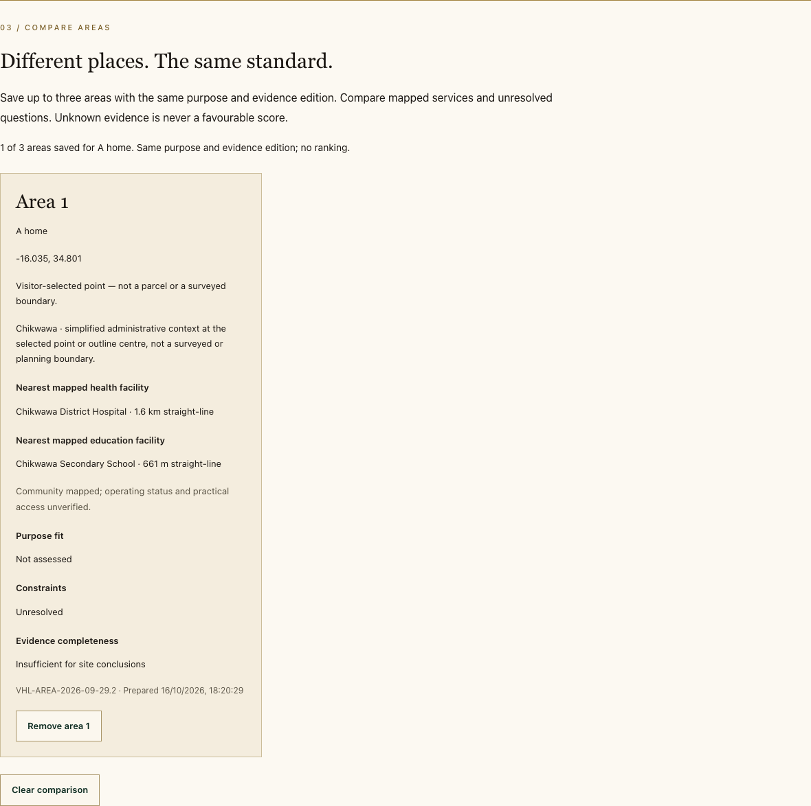
Prepare the first report and choose Add to comparison. The status tells you how many of the three spaces are filled.
- Choose the next location
Return to the map, place a new pin or draw a new outline. Keep the same purpose, prepare its brief and choose Add to comparison again.
- Read side by side
Check coordinates, nearby mapped services, unresolved constraints and evidence gaps. Use the same purpose, report format and evidence edition. Distances and missing records need interpretation.
- Manage the set
Remove area 1, 2 or 3 deletes that saved comparison card. Clear comparison removes the set so you can start again, including with a different purpose. Duplicate locations are not added twice.
English · 16 October 2026
Download your report and email VHL
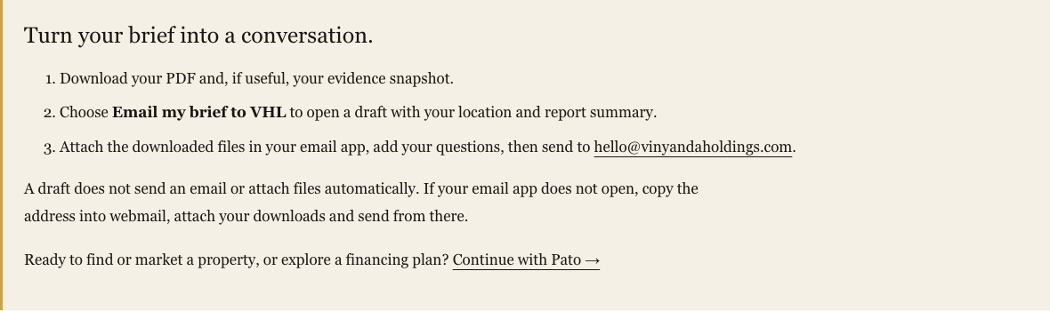
Send the generated information to hello@vinyandaholdings.com with the downloaded report attached. You stay in control of the message.
- Download the files
After preparing a current brief, choose Download PDF for a readable report. Download evidence snapshot saves its structured JSON data, including the selected geometry and source information.
- Open the email draft
Choose Email my brief to VHL. The draft is addressed to hello@vinyandaholdings.com and includes your exact point coordinates, selection type, purpose and a short report summary.
- Attach and send
In your email app, attach the PDF and, if useful, the JSON snapshot. Add your objective, timing, approximate budget and questions. Check the recipient and attachments, then press Send in your email app.
- If your email app does not open
Open your usual webmail, create a message to hello@vinyandaholdings.com, state the location and purpose, attach the downloads and send. Check Sent or any delivery error in your email service.
English · 16 October 2026
Continue your journey with Pato
Vinyanda’s services have connected roles. Start with understanding the place; continue with the service that fits your next question.
- Planning Atlas: understand a place
Drop a pin or draw a selection to explore mapped features, nearby services, source evidence and unresolved questions. Prepare and keep the area brief.
- VHL: discuss your findings
Send the generated brief and questions to hello@vinyandaholdings.com. Explain whether you want to find land, discuss existing rights, market a property or explore a project.
- Pato: market or find real estate
Choose Continue with Pato, or visit https://pato.vinyandaholdings.com. Pato is the intended destination to help market and find real estate and plan for financing.
- Carry your information with you
Keep the report, location, purpose, budget and questions ready. The link opens a separate service; your Atlas brief, contact details and comparison are not automatically transferred. Follow Pato’s own available steps.
English · 16 October 2026
Contact, consent and your information
Choose the contact route that matches your need. An exploratory report and an optional location enquiry are different actions.
- General questions
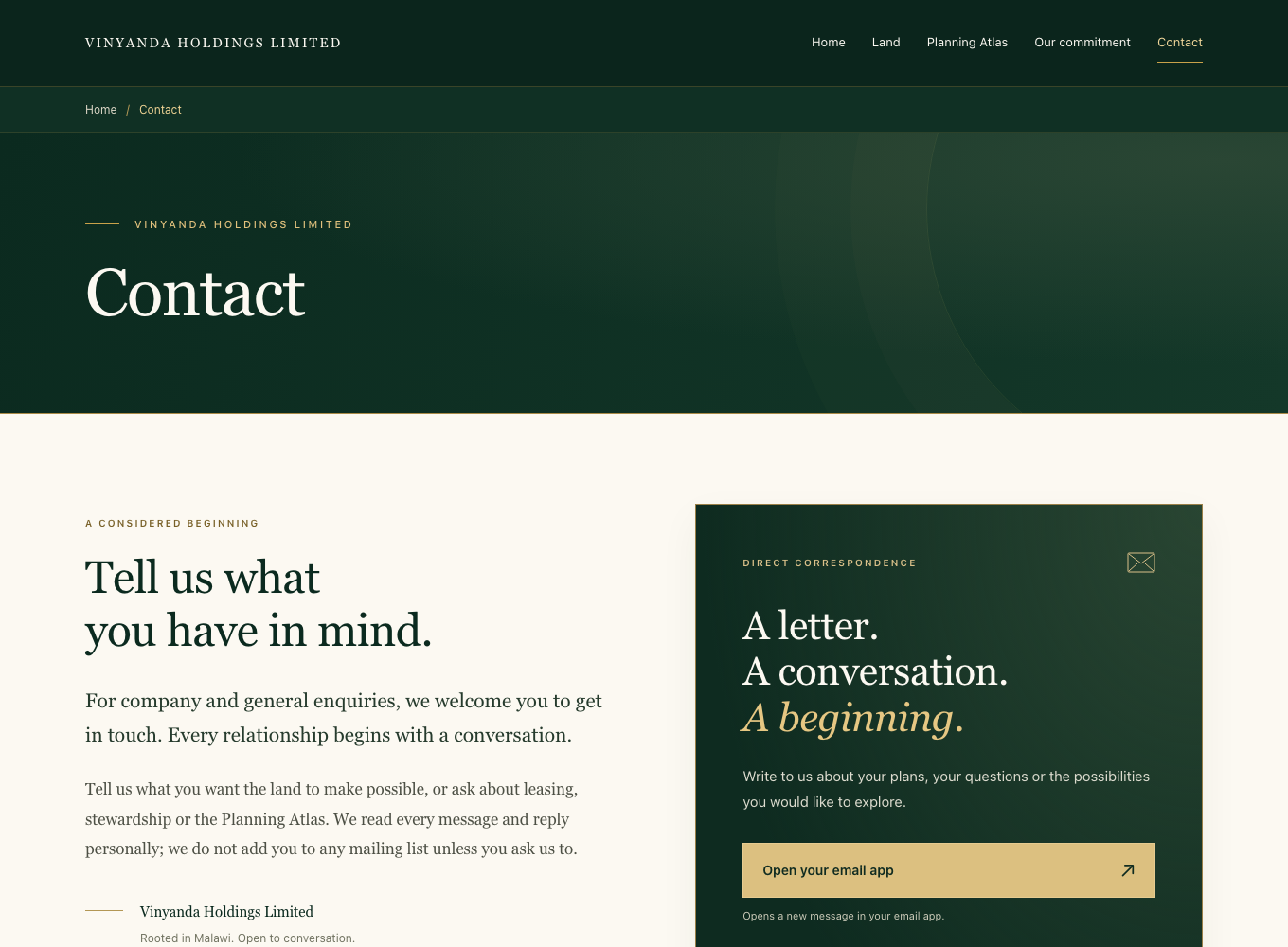
Open Contact, choose Open your email app, write your question and send from your email app. Or copy hello@vinyandaholdings.com into webmail. You can also call +265 999 237 781.
- Discuss a selected location
Below the map, open Optional: discuss this location with VHL. Enter your name, email, optional country and intended use. Read and tick location consent, then choose Discuss this location with VHL.
- Check confirmation
An enquiry is recorded only when a reference is shown. Keep that reference. If no reference is issued, read the status, keep your entries and retry or contact VHL. This action does not prepare or attach a report.
- Know what is shared
Public brief preparation needs no contact details. A location enquiry shares the location and contact details you consent to provide. Downloads contain your selection. Map providers receive ordinary map requests. Read Our commitment and Responsibility for context.
English · 16 October 2026
Get unstuck and build confidence
Use this recovery checklist whenever the page, map or report behaves differently from what you expect.

- Map or data is missing
Check your connection and read the status beneath the map and layers. Try Low-data mode or exact coordinates. Background tile failure can leave pins and other controls usable. Missing source data must remain unknown.
- No selection or brief is stale
Choose a specific point, use Pin map centre, or complete an outline. Check Current selection, choose a purpose, then prepare again. A district boundary alone is not a point. If the register fails, retry later or read Sources.
- PDF, email or Pato will not open
Retry the PDF or download the evidence snapshot. Find downloads in your browser’s Downloads list. For email, use webmail with the address and attachments. If Pato is unavailable, contact VHL with your saved brief.
- Keyboard, phone and guided help
Use Tab and Shift+Tab to move, Enter or Space to activate controls, and Escape to cancel pin placement or close the tour. Use exact coordinates for a keyboard-friendly point. Take a guided tour offers Previous, Next and English / Chichewa; it explains the interface without selecting or sending anything.
ON YOUR PHONE · 16 October 2026
Draw an area with your finger
Outline a place on your phone. Atlas turns the shape into boundary coordinates and an exploratory area brief.
- Find and frame your place
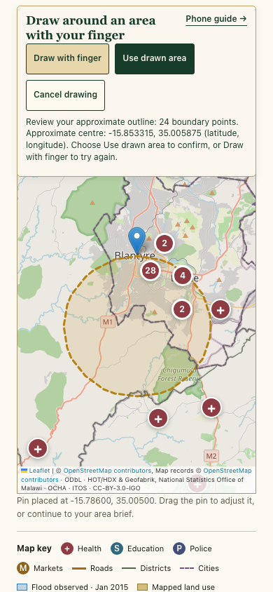
Open Planning Atlas and search for your place. Zoom and move the map until the whole area fits. Use two fingers to zoom before drawing.
- Trace one loop
Tap Draw with finger. Trace around the boundary with one finger. Lift your finger to close the outline automatically. Normal map movement pauses while you draw.
- Review, then confirm
Check the draft outline and its centre coordinates. Tap Use drawn area to confirm. The location details show approximate area; the report records the boundary coordinates. Cancel drawing keeps your last confirmed location. To try again, cancel and start again. For precise corners, use the polygon tool: tap each corner and the first corner again.
- Create and keep your report
Tap Use this location, choose your purpose, then Prepare my area brief. Read the report, choose Download PDF and, if useful, Download evidence snapshot. Email my brief to VHL opens a draft to hello@vinyandaholdings.com; attach your downloads yourself and send it.